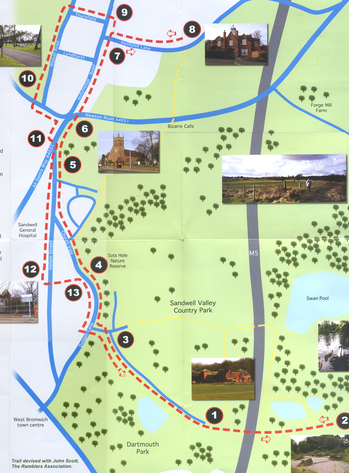
The walk takes about three hours.
It is just over 6 miles long over mixed terrain and there are alternative routes for wheelchairs and push-chair users.
The walk is marked by red dotted line on the map. It is just over 5 miles long and roads and tracks suitable for pushchair and wheelchairs. Allow three hours. The map also marks alternative yellow route for more serious walkers, which crosses fields which may be muddy in wet weather.
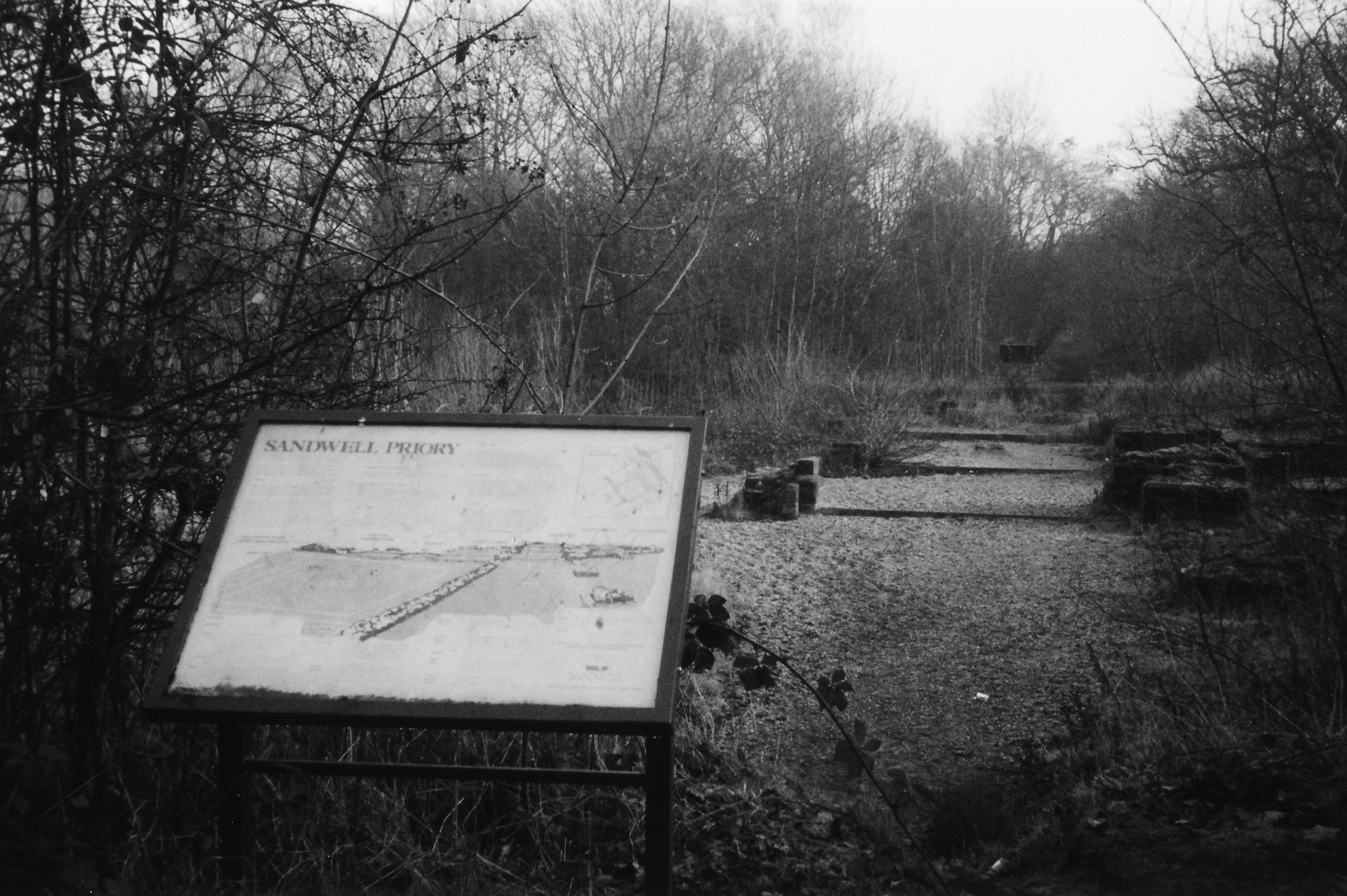
One: From the car park at Sandwell Park Farm, go through gate (maybe locked but is accessible for those on foot or on a bike) in right hand corner along the track of a Motorway bridge and straight on, ignoring first turning on the left, to the Sandwell Priory ruins (muddy in winter).
Two: From the Priory retrace your steps back along the track over the M5 bridge and back to car park start point. An alternative route is to turn right along the footpath, pass the two ponds over the motorway bridge, then turning left following signs back to Sandwell Park Farm. This is paved.
Three: Go uphill to the entrance of Sandwell Valley Country Park and turn left, to T-junction with Dagger Lane. Follow the right hand pavement along Dagger Lane.
Four: Go past Hill House, around the bend by Sots Hole. Keep on the right hand pavement, passing Temple Meadows Road, Hallam Street and and Parsonage Street junctions, and the old animal pound on the left along Church Vale.
Five: Join All Saints Way on the right. The church of All Saints is a short way along All Saints Way on your right.
Six: By the church, cross over the pedestrian lights at the end of Newton Road and proceed along the right hand pavement on Holyhedge Road.
Seven: Turn second right into Penny Hill Lane. Proceed along Penny Hill Lane, crossing over to the left-hand pavement.
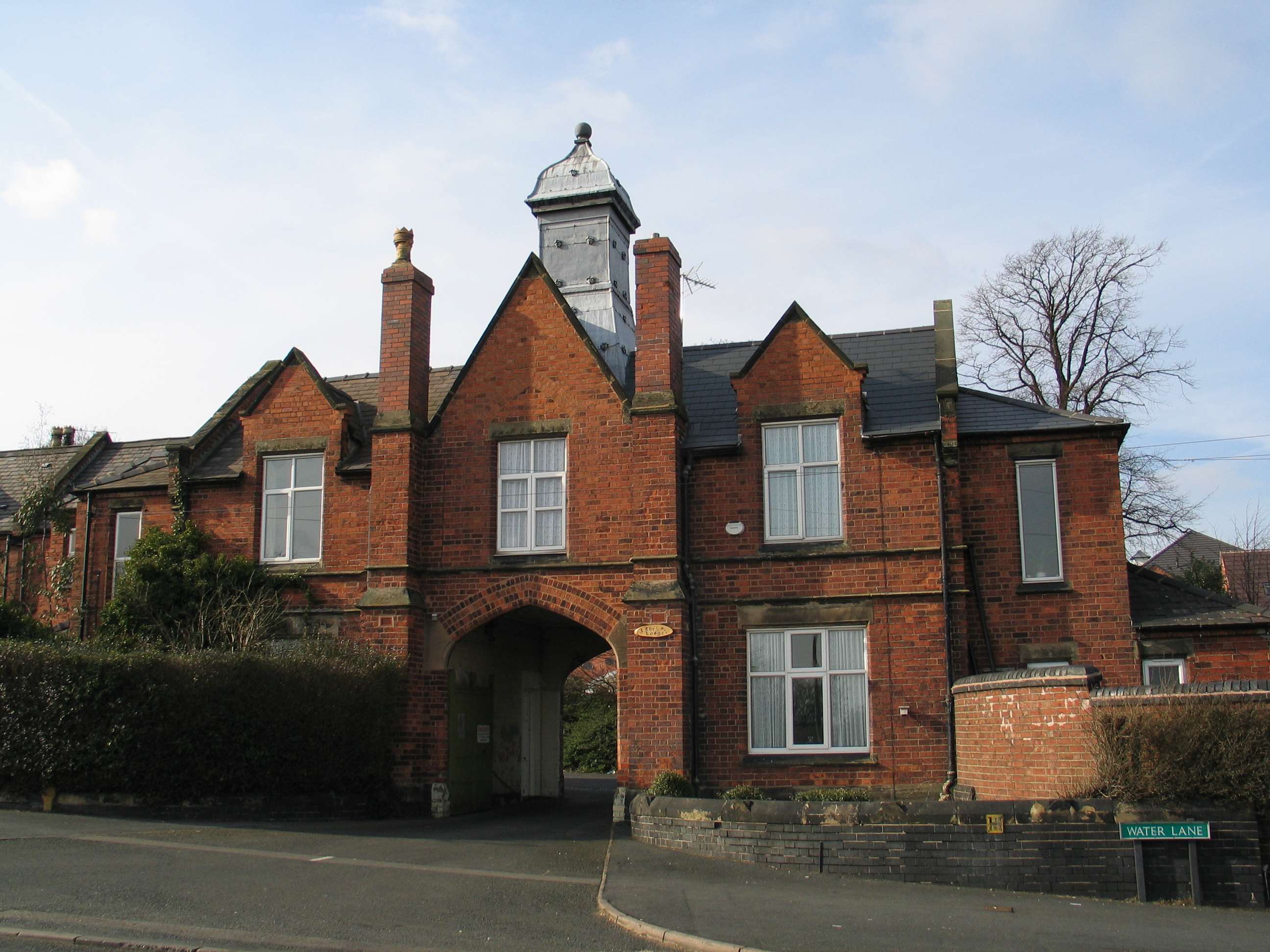
Eight: After passing Hartland Road, the gatehouse entrance to the former Wigmore School is on the left. Retrace your steps along Pennyhill Lane to T-junction with Hollyhedge Road.
Nine: Turn right and follow the right-hand pavement to cross Hollyhedge Road at the pedestrian crossing by Willet Road. Turn back along the right-hand pavement in Holyhedge Road to turn right into Thursfield Road. At the end of Thursfield Road, turn left along Walsall Road. After 100 yards cross over Walsall Road at the refuge by the junction of Lyndhurst Road and proceed to the entrance of West Bromwich cemetery.
Ten: The Pauper Memorial monument is on the right. To leave the cemetery, take the first path on the left to Heath Lane gate. After leaving the cemetery, cross over Heath Lane at the traffic lights to proceed along the right-hand pavement of Heath Lane and All Saints way.
Eleven: Turn right along the right-hand pavement of All Saints Way to turn left through the underpass. Upon reappearing on the left-hand side of All Saints Way, turn right along the pavement. Fork left along Church Vale with the old animal pound on the green on the right. Cross over Church Vale and continue along the left-hand pavement onto Hallam Street.
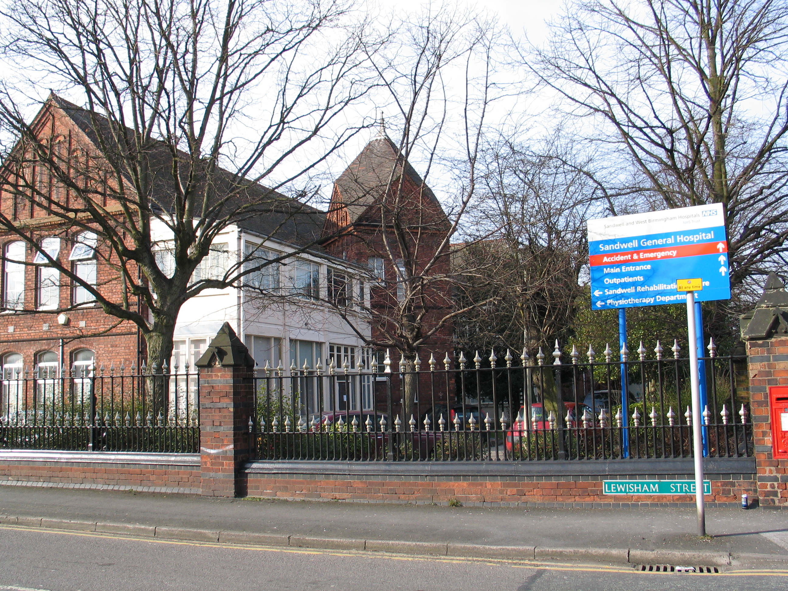
Twelve: On Hallam Street you will arrive opposite old buildings of Hallam Hospital (now part of Sandwell General Hospital) on the right. This is the site of the Union Workhouse. From here, look for the footpath across the car park opposite the hospital, marked with black and yellow posts, which takes you back to Church Vale opposite Sots Hole entrance.
Thirteen: Turn right into Church Vale, which then becomes Dagger Lane, crossing the road to take a left-hand pavement. Hill House is situated on the left. Carry on past Hill House to turn left into Salters Lane. Turn right at the large gate into Lodge Hill Road to return to park farm car park at the bottom of the hill.
Trail devised by John Scott, The Ramblers Association
DOWNLOAD PaupersTrail/pdf